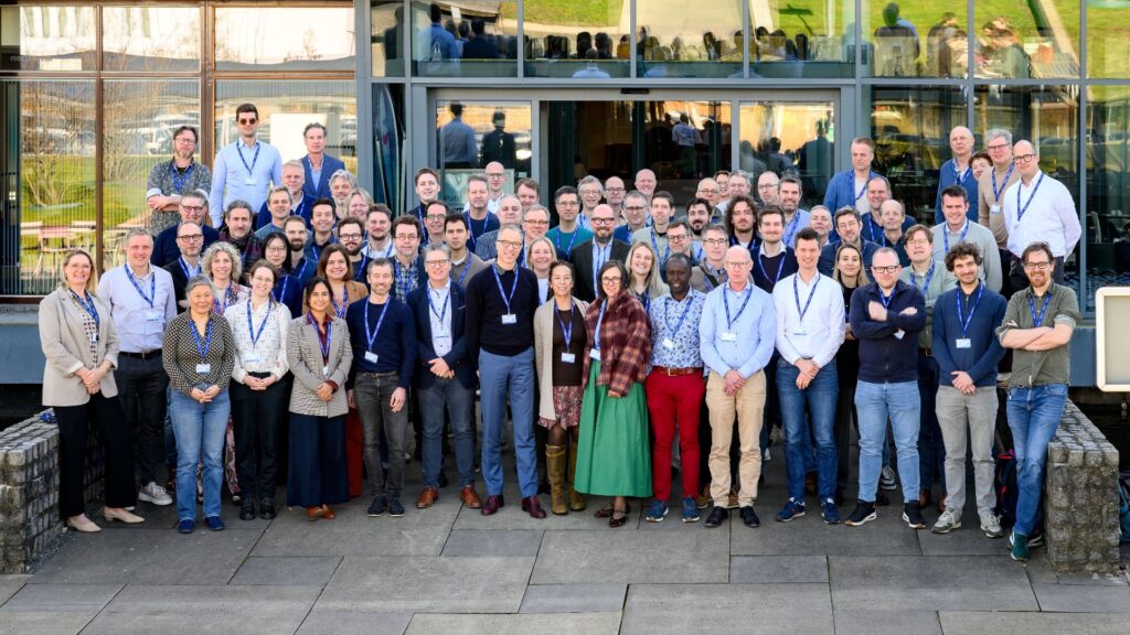
On Friday 19 June, the DigiShape community gathered at MARIN in Wageningen for the DigiShape day From data to realisation: digitisation for the North Sea 2040. The DigiShape day was fully booked, showing how much interest there is in digitization as an accelerator of the North Sea task towards 2040.
The central question: how does digitisation help to better understand, weigh up and make feasible the major challenges in the North Sea? That question was looked at from several angles. In the morning, it was about policy, strategy and the digital preconditions for cooperation. TNO, Deltares and MARIN then translated it into knowledge, models and applications for spatial planning in the North Sea. In the afternoon, participants continued to work in parallel sessions on concrete applications, including on data, open-source simulation and digital solutions for the North Sea tasking.
On this page you will find the retrospective, presentations and videos.
Keynotes on data, energy and the North Sea
Dutch Data Space Physical Living Environment
Martin Peersmann of the Ministry of the Interior and Kingdom Relations (DGRO) gave a presentation on the Dutch Data Space Physical Living Environment. He showed why a good data foundation is needed for digital collaboration between governments, knowledge institutions and market parties.
An important theme was federated data sharing. Data remains at the source, while organizations can provide secure access to relevant information through joint agreements and standards. This is important for data sovereignty: organizations keep control over their own data and can still share it responsibly. Martin also discussed basic registers 2.0, open standards, governance and the role of data spaces in digital twins and AI applications.
Download the presentation by Martin Peersmann
Watch the video of the presentation

Future of Energy at Sea
Ruud Cino of the Ministry of Economic Affairs and Climate Policy took the participants through the task of energy at sea. The ambitions are great: 23 GW of offshore wind energy by 2033, 40 GW by 2040 and 70 GW by 2050. This requires smart choices in the use of space, infrastructure, nature, safety and innovation.
In his presentation, it emerged that the energy transition in the North Sea is not just a physical task, with wind farms, cables, pipelines and hydrogen production, but also a digital task. Reliable data, good connectivity, cybersecurity and cooperation with parties such as the Ministry of Defence are important preconditions. He also emphasized the importance of innovation zones: places where new technologies can be tested and further developed at sea.
Download the presentation by Ruud Cino
Watch the video of the presentation on YouTube

Knowledge institutions on spatial planning, cooperation and shipping
Maritime spatial planning, North Sea energy program
Aravind Satish of TNO presented a multi-objective spatial optimisation tool for spatial planning in the North Sea. This tool helps to weigh up different space claims, such as wind energy, oil and gas infrastructure, carbon capture and ecological sensitivities, at the same time.
The tool largely works with public data and shows several possible solutions. In this way, the tool supports experts in making choices, without completely adopting those choices. An important point of attention is trust. By involving stakeholders, such as fisheries and other users of the North Sea, at an early stage and using sensitivity analyses, it becomes clearer how input data influences the outcomes.
Download the presentation of Aravind Satish
Watch the video of the presentation on YouTube (English spoken)

Greater North Sea Basin Initiative
Sharon Tatman and Luis Rodriguez Galvez from Deltares gave a presentation on the Greater North Sea Basin Initiative. This voluntary partnership brings together nine countries around the North Sea to coordinate earlier and better on spatial planning at sea.
The presentation showed that many tasks are cross-border. Shipping, ecology, wind energy and data flows do not stop at national borders. That is why joint maps, shared data, transparent metadata and good agreements are needed. It also became clear that the ecosystem of the North Sea is under pressure. This makes precaution, knowledge sharing and early dialogue between countries and sectors extra important.
Download the presentation by Sharon Tatman and Luis Rodriguez Galvez
Watch the video of the presentation on YouTube (English spoken)

MSP Shipping perspective
Yvonne Koldenhof of MARIN showed how dynamic shipping is in the North Sea. Shipping routes sometimes look like fixed lines on maps, and in practice, traffic flows change due to weather, incidents, infrastructure and captains’ choices.
Using traffic data, she showed that some main routes handle almost 80 ships per day in each direction. In addition, ships need more space than is immediately visible on a map. Wind farms, safety zones and incidents can change sailing behaviour. For spatial planning, this means that models must not only look at fixed routes, but also at dynamics, risks and practical knowledge from the sector.
Download the presentation by Yvonne Koldenhof
Watch the video of the presentation on YouTube (English spoken)

Parallel sessions with a practical approach
In the afternoon, participants split up into parallel sessions by Periplus Group, Informatiehuis Marien and Van Oord. The step from data to application was central to this: how do you make digital solutions usable for the practice of the North Sea? This resulted in fruitful discussions.
Guided tour at MARIN
During lunch, MARIN gave a tour of the research facilities. This gave participants an insight into the place where a lot of knowledge about shipping, offshore, safety and maritime innovation comes together. The tour showed how model research, data and practical questions reinforce each other in complex tasks at sea.
RWS challenge: 14 pitches for machine learning on wave parameters
During the DigiShape day, attention was also paid to the RWS challenge on machine learning for wave parameters. For this challenge, for which we made a call from DigiShape, no fewer than 14 pitches were given. In doing so, the day also showed how much energy there is in the network to contribute to the North Sea task with data, AI and models.