On Wednesday, November 15, from 11 a.m. to noon, the DigiShape AI working group is hosting an online technical session with Taj de Vries from Nelen & Schuurmans on Algorithmic determination of water levels with remote sensing.
Determination of water levels by applying algorithms on remote sensing data
The Netherlands has 225000 km of water bodies managed by water authorities. In many of these water bodies, the water level is not measured due to cost efficiency. For policies such as “water and soil in the lead” and the strength of dikes, it is important that a water level is maintained (e.g. prevention of oxidation of peat) and that sufficient water is present in the ditch of a dike.
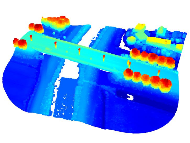
Remote sensing can observe the variation in topography with laser height measurements by satellites and drones. Science proves the applicability of LiDAR for deriving water levels, but it is still not used in practice in the Netherlands. On the one hand, this is due to quality and inaccessibility of such a large datasets at the spatial scale of water bodies. In this innovation project an information service will be made to determine water levels by applying algorithms on remote sensing data in such a way it is applicable for water authorities.
Practical information
- What: Online technical session
- When: Wednesday, November 15, from 11 to 12 a.m.
- Location: Microsoft Teams
- Register here